


Maps for Download
Maps are pdf georeferenced, except for Street Atlas. With the appropriate mapping software apps and GPS enabled mobile devices, this allows the user to view their locations on the map.
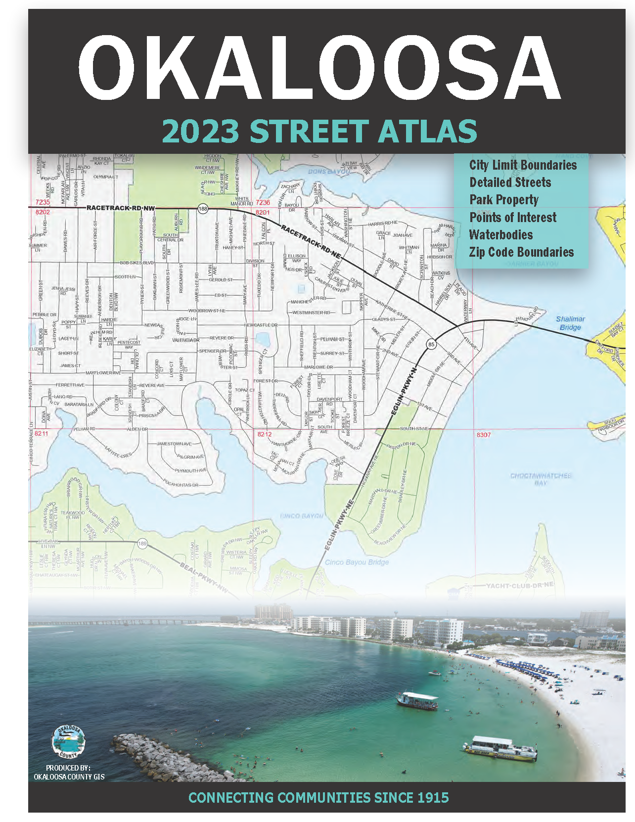 |
2023 Street Atlas of Okaloosa County An 8 1/2 x 11 inch document containing a grided map index, street listing index, and over 60 maps showing airports, city limits, emergency places of interest, parks, schools, water bodies, and zip code boundaries. |
DISCLAIMER: Okaloosa County hereby expressly disclaims any liability for errors or omissions in these data sets, maps, indexes or legends and makes no warranties, expressed or implied, concerning the accuracy, completeness or suitability of these products.
Checking this box enables downloads and that you accept the above statement.
County Area Map 36" x 48" page size
Crestview Area Map 36" x 48" page size
Destin Area Map 36" x 48" page size
Florosa Area Map 36" x 24" page size
Fort Walton Beach Area Map 36" x 48" page size
Evacuation Routes and Shelters Map 8.5" x 11" page size
Large Evacuation Zone Maps
Fort Walton Beach 40" x 36" page size
8.5 x 11 Evacuation Zone Area Maps
Large Surge Zone Area Maps
Fort Walton Beach 40" x 36" page size
8.5 x 11 Surge Zone Area Maps
8.5" x 11" page size District Map
11" x 17" page size District Map
24" x 36" page size District Map
36" x 48" page size District Map
Additional Information
Commissioner Redistricting Statistics
Legal Descriptions Commissioner Districts 1 to 5
*For historical commissioner maps contact the GIS department at 850-651-7570.
Other Districting Maps
County Fire Districts 36" x 48" page size
Florida House 36" x 48" page size
Florida Senate 36" x 48" page size
US Representatives 36" x 48" page size
County School Board 36" x 48" page size
County Voting Precincts 36" x 48" page size
Tourist Development Tax Districts
Contact the GIS Dept for printed maps:
Payment in advance is required for all print map requests; credit cards not accepted.
Existing maps can usually be printed at the time of purchase. The Street Atlas Map Book usually requires a 1 to 2 week printing and binding turnaround time.
For customized maps please contact our office for pricing and print turn around time.
 Office: 850-651-7570
  Email GIS
Price list for existing maps:
| Page Size | Cost | Additional |
|---|---|---|
|
8.5" x 11" or 11" x 17" |
$1.00 |
N/A |
|
30" x 36" or smaller |
$10.00 |
with aerials $12.00 |
|
36" x 48" |
$15.00 |
with aerials $18.00 |
|
Street Atlas Map Book |
$35.00 |
|
Eddie Quinlan, GISP GIS Manager
Department of Information Technology
equinlan@myokaloosa.com
1250 Eglin Pkwy N Suite 303
Shalimar, FL 32579
Office: 850-651-7570
Fax: 850-651-7576
302 N. Wilson St. - Suite 302
Crestview, FL 32536
1250 N. Eglin Parkway, Suite 100
Shalimar, FL 32579
Call 850-689-5050 or 850-423-1542 for all departments.
Copyright © 2015 Okaloosa County, Florida. All rights reserved.
